

Latest Weather Blog
Flood Watch issued ahead of heavy rain threat Thursday and Friday
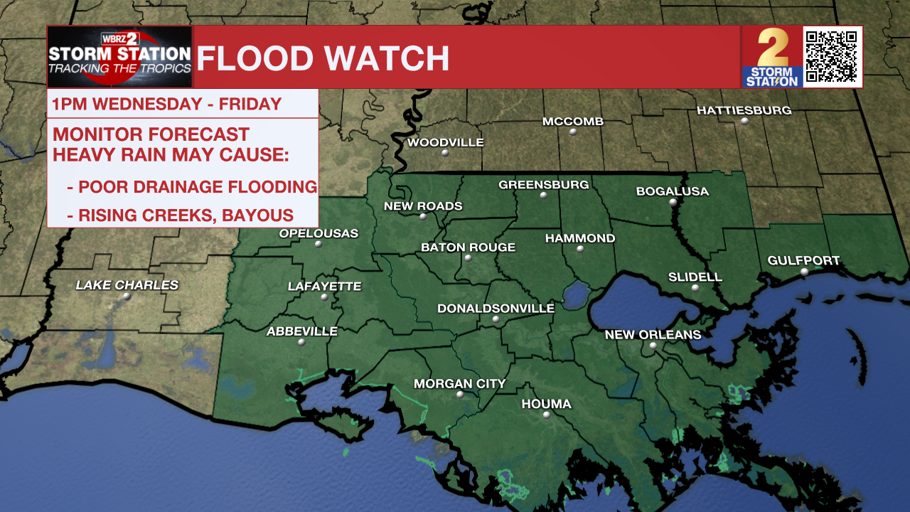
The National Weather Service has issued a ***FLOOD WATCH*** for East Baton Rouge, West Baton Rouge, Ascension, Assumption, Iberville, East Feliciana, Livingston, Pointe Coupee, St. Helena, St. James, Tangipahoa, and West Feliciana Parishes. It will go into effect Wednesday afternoon and last through Friday night. A FLOOD WATCH means conditions may develop that lead to flash flooding. Flash flooding is a very dangerous situation. Be on the lookout for threatening weather conditions and listen for later statements and possible warnings. For more on flooding safety, CLICK HERE.
Tonight: Rich, tropical moisture will move into the atmosphere on Wednesday night. As this occurs, clouds will thicken and isolated showers and thunderstorms will be possible with an increase in rain coverage before dawn. Due to the tropical moisture, it will stay warm and muggy with lows in the upper 70s.
Thursday & Friday: A weak tropical disturbance will influence our weather on Thursday and Friday. Associated moisture will lead to a couple of days in a row with very high rain coverage. Largely manageable rainfall totals of 2–5" are likely, with locally higher amounts possible, especially near the coast. Some bullseyes near 10" will be possible. In these locations, isolated flash flooding may occur. Exactly where the heaviest rain falls will not be clear until the bursts of activity begin to develop over land. Each day, highs will stay in the upper 80s due to cloud cover and precipitation.
Up Next: Over the weekend, the tropical moisture will slowly begin to depart, leading to a reduction in rain coverage. Of the two days, Saturday will be busier with scattered showers and thunderstorms enhanced by daytime warming. Sunday will only have isolated activity, allowing high temperatures to climb back well into the 90s. Next week looks like a return to average summer weather with heat, humidity, and pop-up, afternoon thunderstorms.
Trending News
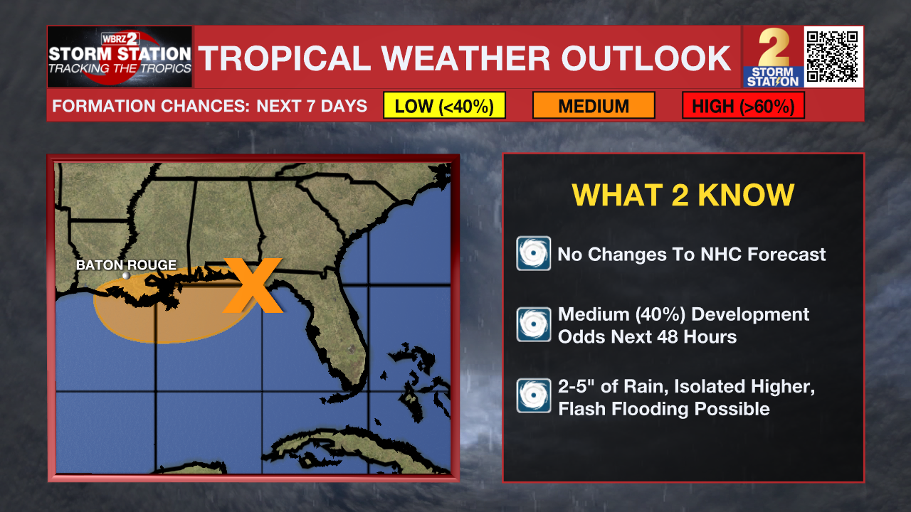
The Tropics: (Wednesday 1 p.m. Update) Surface and radar observations indicate that a westward-moving broad area of low pressure is located along the coast of the Florida Panhandle near Panama City. The associated shower and thunderstorm activity remains disorganized and is located mainly south and southwest of the center. This system is forecast to continue moving westward across the northern portion of the Gulf through tonight, reaching the coast of Louisiana by Thursday. If this system moves far enough offshore, environmental conditions over the Gulf appear generally favorable for additional development, and a tropical depression could form over the next day or two before the system moves fully inland by the end of the week. Regardless of development, heavy rainfall could produce localized flash flooding over portions of the north-central Gulf Coast beginning late today and continuing through Friday.
Get the latest 7-day forecast and real-time weather updates HERE.
Watch live news HERE.
– The Storm Station
The Storm Station is here for you, on every platform. Your weather updates can be found on News 2, wbrz.com, and the WBRZ WX App on your Apple or Android device. Follow WBRZ Weather on Facebook and X for even more weather updates while you are on the go.
More News
