

Latest Weather Blog
Monday PM Forecast: Returning showers by midweek, another round by weekend
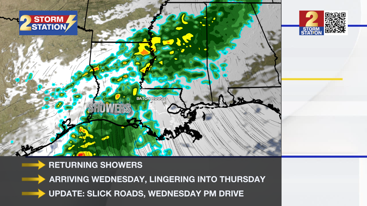
Tuesday will begin cold but end seasonably cool, with the entire day staying free of major impacts. That will change by midweek with the return of showers. Another surge in rain chances arrives closer to the weekend, and wintry weather isn't totally off the table with that round.
Tonight & Tomorrow: Expect another cold night ahead, although temperatures won’t fall as low as they have over the past two nights. Thermometers will fall through the 40s during the evening and drop into the 30s after midnight. By daybreak, lows will settle near or just below freezing along and north of I-12, while areas farther south stay in the mid-30s. Take steps to protect plants, keep pets warm, and wear layers before heading outside — nothing unusual for the time of year. Tuesday looks similar to Monday, with highs near 60°. Thin, high clouds will appear throughout the day, signaling the first signs of midweek changes.
Midweek Rain: Clouds will increase into Wednesday, setting the stage for another round of showers as a disturbance arrives. The overall rain coverage will increase as the day progresses. Isolated showers will be possible during the drive home, so be alert to slick roads and be prepared to face possible delays. Despite the dreary day, a warming southeast wind will push highs into the lower and middle-60s. With the disturbance moving out on Thursday and Friday, showers should be fewer in number. That said, don’t be surprised by some light, off-and-on showers from time to time. Temperatures will be warmer during that timeframe, with highs near 70° and lows in the 50s.
Winter Returns: Another storm system appears to get going on Saturday, opening the door for another wave of rain. Meanwhile, a frigid Arctic air mass will begin inching toward the Gulf Coast. This system could bring winter weather impacts, especially along the I-20 corridor, where freezing rain appears increasingly likely. If temperatures drop quickly into Saturday night, there’s even a chance for a transition to freezing rain along the I-10 corridor. For now, the Storm Station leans toward a freezing rain event mainly north and west of Baton Rouge, with mostly cold rain elsewhere. Even in an all-rain scenario, moisture left on bridges and elevated roads could freeze Sunday morning, making travel slippery and dangerous. All considered, it only takes a minor shift to change the outcome, so check back later in the week as forecast confidence improves.
Into Sunday and early next week, precipitation will quickly depart, and cold air will become the main focus. By Monday, look for highs in the 40s with lows in the 20s.

Trending News
Get the latest 7-day forecast and real-time weather updates HERE.
Watch live news HERE.
— Meteorologist Malcolm Byron
The Storm Station is here for you, on every platform. Your weather updates can be found on News 2, wbrz.com, and the WBRZ WX App on your Apple or Android device. Follow WBRZ Weather on Facebook and X for even more weather updates while you are on the go.
More News
