

Latest Weather Blog
Flood Watch issued in advance of tropical soaking
A HEAT ADVISORY will be in effect from 10 a.m. - 7 p.m. Wednesday for many around the Capital Area, including East Baton Rouge, West Baton Rouge, Ascension, Assumption, Iberville, East Feliciana, Livingston, Pointe Coupee, St. Helena, St. James, Tangipahoa, and West Feliciana Parishes as well as, Amite and Wilkinson Counties. Expect feels-like temperatures as hot as the 105-110° range for several hours during the afternoon. Drink plenty of fluids, wear light clothing, and take breaks during the hottest parts of the day.
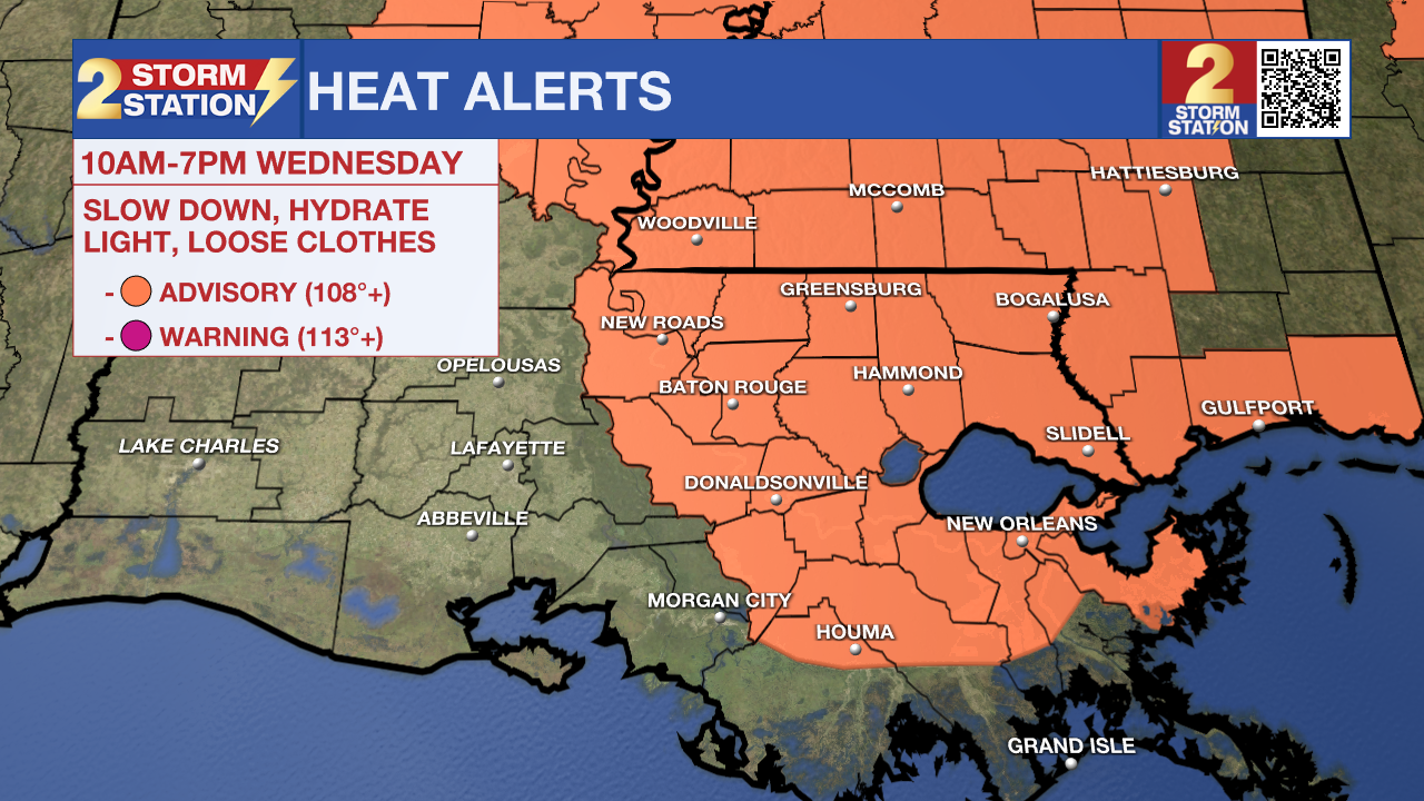
Tonight & Tomorrow: Expect mainly clear conditions in the overnight hours with lows in the middle 70s. Wednesday will be the last day of the summertime pattern before major changes. It will be hot with highs in the middle 90s. Humidity will make that feel closer to 105-110 degrees at times, so make sure you are drinking plenty of water. As for afternoon storms, not too many of them are expected. Storm coverage will be isolated in nature. By the evening, clouds will begin to increase across the area, signaling changing conditions.
The National Weather Service has issued a ***FLOOD WATCH*** for East Baton Rouge, West Baton Rouge, Ascension, Assumption, Iberville, East Feliciana, Livingston, Pointe Coupee, St. Helena, St. James, Tangipahoa, and West Feliciana Parishes. It will go into effect Wednesday afternoon and last through Friday night. A FLOOD WATCH means conditions may develop that lead to flash flooding. Flash flooding is a very dangerous situation. Be on the lookout for threatening weather conditions and listen for later statements and possible warnings. For more on flooding safety, CLICK HERE.
Up Next: The weather will take on a tropical influence by the end of the week as a tropical wave brings extreme moisture amounts to south Louisiana. This will lead to several days in a row of very high rain coverage beginning late Wednesday through the weekend. Rainfall totals of 2–5" are likely, with locally higher amounts possible, especially near the coast. Some bullseyes near 10" will be possible. Isolated flash flooding cannot be ruled out due to the chance of heavy rains over three days. Exactly where the heaviest rain falls is still being determined, so make sure to check in often for new information. More on the system's potential development is outlined below.
Trending News
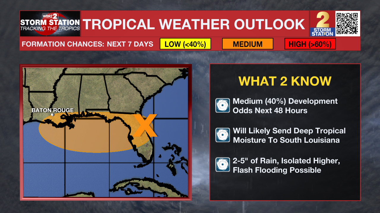
The Tropics: Satellite and radar data indicate that the low pressure area previously over the Atlantic is moving onto the coast of northeastern Florida. This system is currently producing disorganized shower and thunderstorm activity, and little development is expected through tonight while the center is over land. Once the system reaches the northeastern Gulf on Wednesday, environmental conditions appear generally favorable for additional development, and a tropical depression could form while the system moves across the northeastern and north-central Gulf and approaches the coast of Louisiana on Thursday.
Get the latest 7-day forecast and real-time weather updates HERE.
Watch live news HERE.
– The Storm Station
The Storm Station is here for you, on every platform. Your weather updates can be found on News 2, wbrz.com, and the WBRZ WX App on your Apple or Android device. Follow WBRZ Weather on Facebook and X for even more weather updates while you are on the go.
More News
