

Latest Weather Blog
Sunday Evening Video Forecast
Related Story
Despite a warm and muggy start to the week, a strong cold front passage will send temperatures tumbling in just a matter of days.
Tonight & Tomorrow: Clouds won't be much of an issue on Sunday night. That's good news for those hoping to catch a glimpse at a comet in the early evening sky. With clear skies and relaxing winds, a few patches of low clouds cannot be ruled out early Monday in select areas. Should those develop in spots, they would burn off after sunrise with daytime warming. Mostly sunny skies will be left over, and that will push the mercury higher on thermometers. Look for a high temperature in the low-90s in the capital area. The humidity will also be noticeable. While not up to summertime thresholds, it will be enough to make it feel muggy at times.
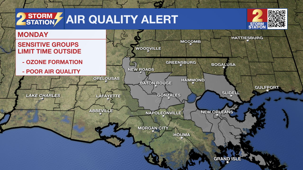
An Air Quality Alert has also been issued for the metro regions of Baton Rouge and New Orleans Monday. Warm temperatures, light winds, and abundant sunshine could lead to ozone formation. Concentrations could rise to levels unhealthy for those with breathing sensitivities, especially during the afternoon.
Up Next: The increased warmth and mugginess on Monday will be in response to approaching cold front. This front will arrive on Monday evening, but not with enough momentum to make a clean pass. Said cold front will stall out in the region on Tuesday. Cooler and drier air will sit north of the boundary, vice versa for areas south. That makes Tuesday's forecast trickier since the weather may vary town by town depending on the location of the front. So if your community ends up on the cooler side of things, that'll be a nice treat. But Tuesday has the potential to be a warm and muggy day.
But on Tuesday night, the cold front finally gathers enough momentum to pass through the area. That will result in some big changes for the rest of the week. Afternoon highs look inviting, sitting in the 70s on Wednesday and Thursday. Morning lows will get quite chilly as well. Some towns might see their first 40s of the season by Thursday morning. It won't last forever, temperatures gradually climb into next weekend. But even then, it looks comfortable with little to no rain in sight.
Get the latest 7-day forecast and real time weather updates HERE.
Watch live news HERE.
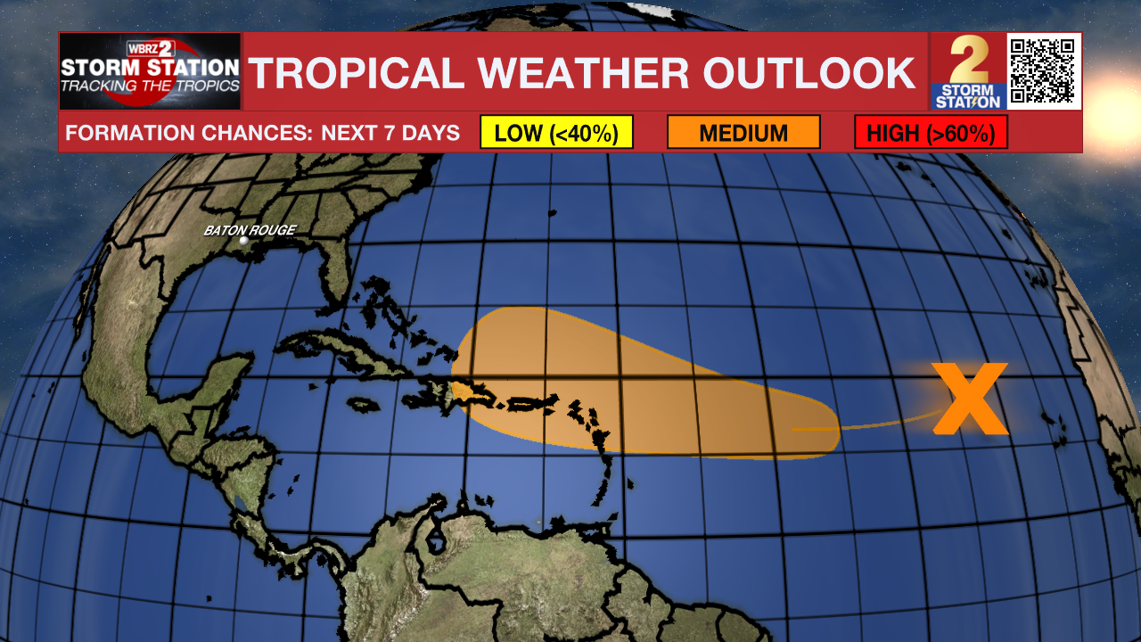
The Tropics: Shower and thunderstorm activity remains limited with a well-defined area of low pressure located several hundred miles west of the Cabo Verde Islands. While the system now sits in an unfavorable region for future development, it may find more suitable conditions by the mid to latter parts of the week. A tropical depression could form as the system approaches or moves near the Leeward Islands by the end of the week. For now, the National Hurricane Center gives the system medium odds of development in the next week.
-- Meteorologist Malcolm Byron
The Storm Station is here for you, on every platform. Your weather updates can be found on News 2, wbrz.com, and the WBRZ WX App on your Apple or Android device. Follow WBRZ Weather on Facebook and Twitter for even more weather updates while you are on the go.
News
