

Latest Weather Blog
A month of rain in twelve hours: Baton Rouge flood of 1967
On April 14, 1967, Baton Rouge experienced a weather event worth remembering, even in a region with a trying history of heavy rain and flooding. A storm system stalled over the region, dumping a record-breaking foot of rain in a matter of hours, paralyzing transportation, and triggering widespread flooding that many residents had never seen before.
The deluge began in the early morning hours of Friday, April 14, 1967. By 11 a.m., the U.S. Weather Bureau at Ryan Airport reported that more than 10 inches of rain had fallen in just nine hours—doubling the city's typical average for the entire month of April.
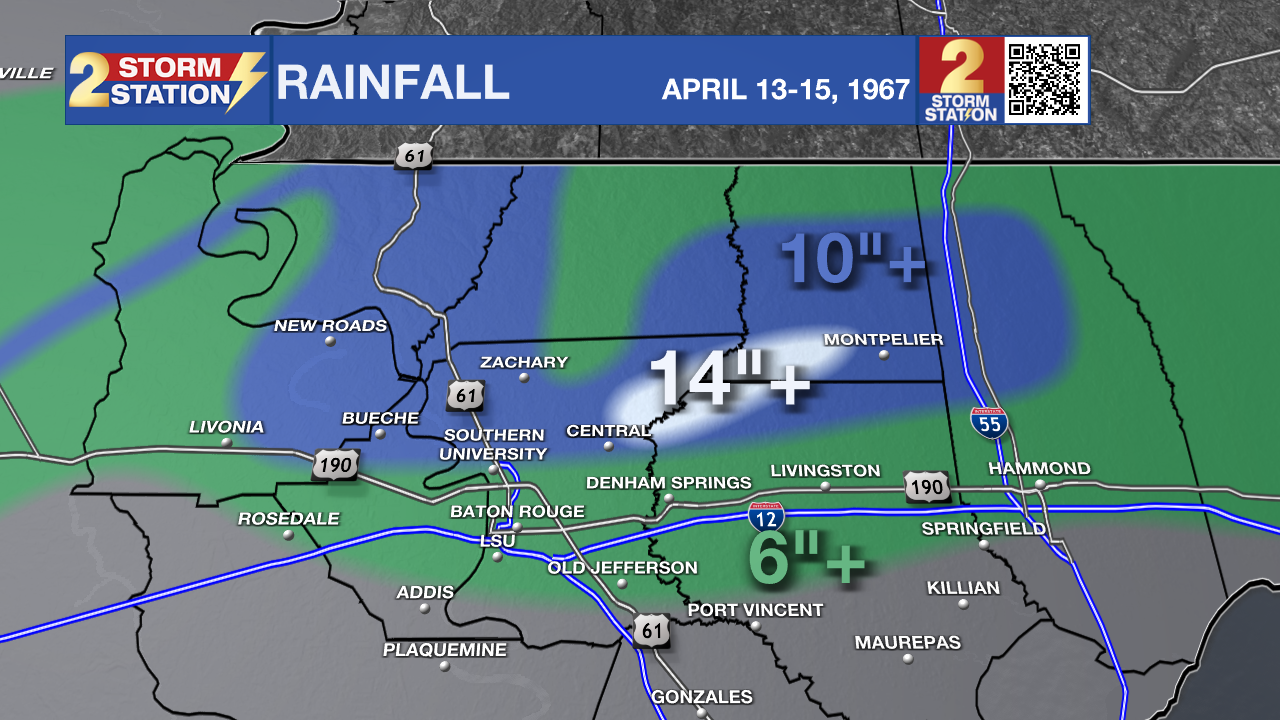
By the time the storm let up, the official record for the day stood at a staggering 11.99 inches of rain. In some parts of the parish, totals were reported as high as 14 inches, falling at a rate of nearly an inch per hour for half of the day.
Cathy Heckman emailed the Storm Station, stating that she remembers the day well:
Trending News
"A neighbor and I worked in the same office. Her son, who was my age, was attending LSU. She said they would pick me up in her car, he would drop us off at the office, and he would go on to LSU. They picked me up at 7:30 a.m. and we drove around until 1:00 p.m., but we never could make it to downtown because of flooded streets. Her car got water in it. My father had to park his car several blocks away from our house after work and walk home because he couldn’t drive through the flooded streets. He left early enough in the morning to get to where he worked on Main Street before the flooding started."
The sheer volume of water overwhelmed the city’s infrastructure. By midday Friday, Mayor-President Woody Dumas declared a state of emergency. Rising water stalled cars on virtually every street and road in the city and parish.
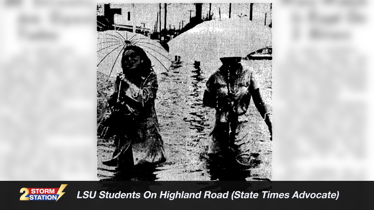
Highland Road, a main artery to LSU, became impassable to vehicles, leaving "foot" as the only means of transportation. School children were dismissed at noon and sent home by bus as officials scrambled to clear streets. Law enforcement used the majority of their vehicle resources to evacuate residents from low-lying areas.
While the city streets began to drain by Saturday, the crisis shifted toward outlying areas as the Amite and Comite Rivers began to swell. In Denham Springs, State Highway Department crews worked with draglines to clear logs and debris from the Amite River bridge to prevent the structure from clogging and failing. Meanwhile, State Police has to intermittently block U.S. Highway 190 at Albany and Denham Springs due to changing water levels.
Governor John McKeithen and Representative John Rarick conducted aerial surveys of the damage on Saturday. At the time, there was debate as to whether or not the event surpassed The Great Flood of 1943, but Mayor-President Dumas noted that houses and businesses in East Baton Rouge were hit that had never been threatened by water before.
.png)
The Storm Station is here for you, on every platform. Your weather updates can be found on News 2, wbrz.com, and the WBRZ WX App on your Apple or Android device. Follow WBRZ Weather on Facebook and X for even more weather updates while you are on the go.
More News
