Thursday AM Forecast: Widespread rain underway, heavier pockets possible
The rain has settled in this morning, with some heavier pockets already occurring across the area. Poor drainage flooding, ponding on roadways, and rising creeks/bayous are possible.

Today & Tonight: Get ready for a very wet start to your Thursday. Widespread rain is moving through, including pockets of heavier downpours. You may want to leave a bit earlier than usual this morning, and be sure to slow down—ponding on the roads could lead to hydroplaning.
The heaviest and most widespread rain will fall during the first half of the day. Coverage will ease a bit this afternoon and evening, but it won’t turn dry, and the overall intensity will gradually back off. With clouds and rain hanging around, highs will only reach the mid-50s.
Overnight, rain chances will drop from daytime levels, though light to moderate showers will linger. Friday’s morning commute will be less soggy, but isolated showers are still possible. Lows will fall into the mid-40s.
Trending News

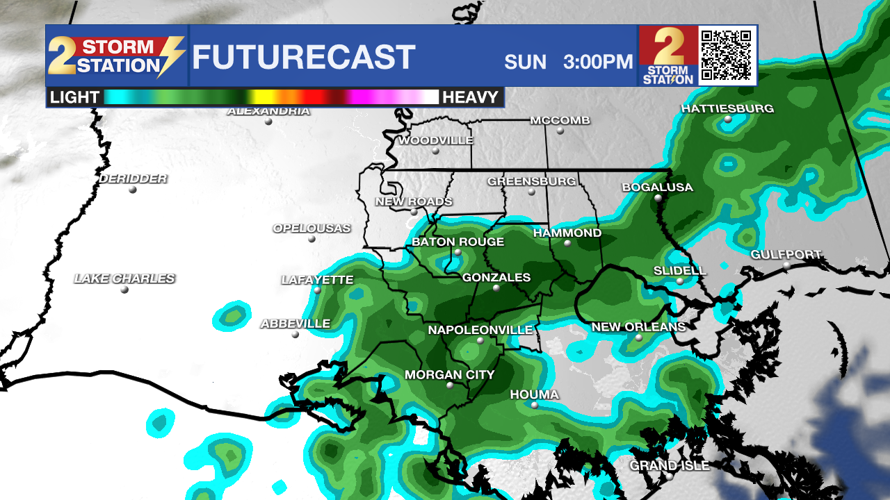
Use the slider to advance through the next 24 hours of Futurecast
More Rain to Follow: Expect the damp, cool pattern to stick around for the rest of the week. Friday will feature plenty of passing showers, coming and going throughout the day, which will make it tough to find long stretches of dry weather. Some of that rain may even hold on into Saturday — a change from previous Storm Station outlooks. While Saturday shouldn’t be a total washout, hit-or-miss showers are still on the table, mainly for areas south and east of Baton Rouge. The forecast is still being fine-tuned, so stay tuned for adjustments, but at this point there’s no reason to scrap outdoor plans. Rain totals through Saturday should land around 1–3", with a few spots possibly topping 4".
Up Next: By Sunday, rain will have mostly fizzled out, allowing temperatures to rebound into the mid-60s. Another cool surge arrives early next week, knocking highs back down into the 50s on Monday and sending lows close to frost levels by Tuesday morning. The cold snap won’t last long, with a slow warming trend returning by midweek.
Get the latest 7-day forecast and real-time weather updates HERE.
Watch live news HERE.
— Balin
The Storm Station is here for you, on every platform. Your weather updates can be found on News 2, wbrz.com, and the WBRZ WX App on your Apple or Android device. Follow WBRZ Weather on Facebook and X for even more weather updates while you are on the go.


