

Latest Weather Blog
Friday PM Forecast: Stormy weekend ahead, much more confident in timing
Our next storm system and next impact will arrive over this busy football weekend. Although heavy rainfall and even severe storms will be possible, the timing is trending in a good direction for LSU and Southern home games.
Next Impact: As a storm system begins to organize to our west, clouds will begin to increase in the overnight hours. Lows will bottom out in the mid-60s. Saturday will start off with mostly cloudy skies, but the morning hours will stay mainly dry. Rain chances will begin to increase right around midday as a weakening line of storms enters from the west. Numerous to widespread showers and storms are expected. Rain will last till around 4-5pm. After that point, a break in the action is expected as the atmosphere reenergizes. A few passing showers, and maybe a thunderstorm will be possible before midnight, but numerous activity is not expected.
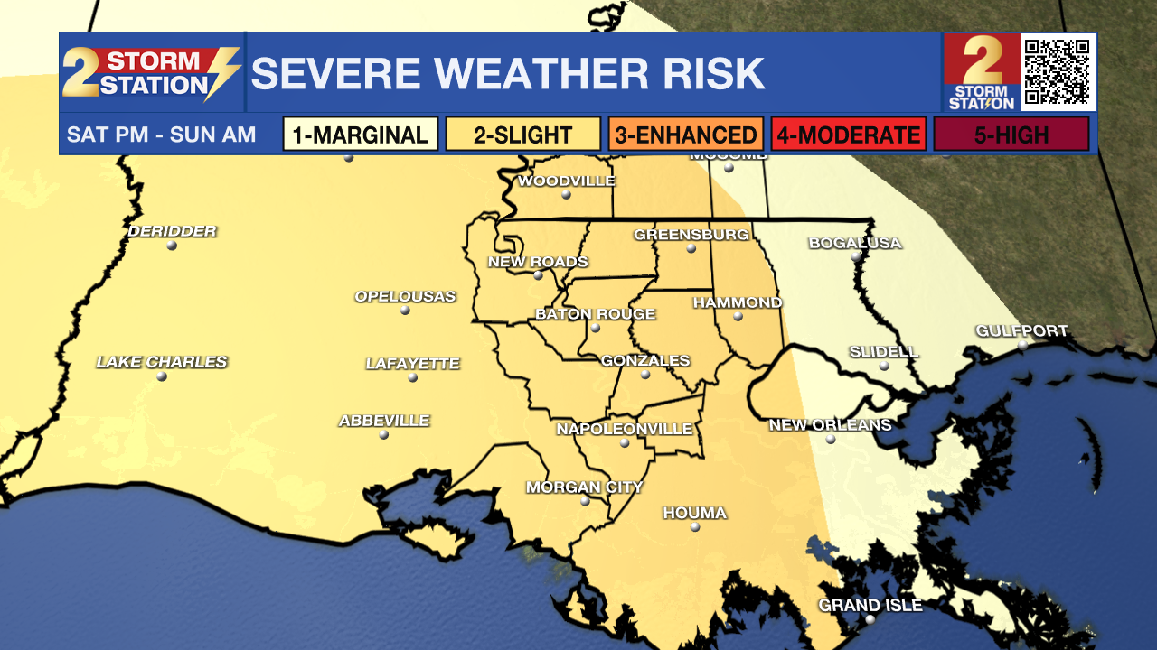
Early on Sunday morning, another line of storms will enter the Capital Area. This one looks like it will pack more of a punch. Heavy rainfall, and even some severe storms will be possible. Gusty winds in excess of 60mph and brief tornadoes will be the main threats. These storm will linger till around 8-9am before we begin to trend drier. Only spotty action is expected for the rest of your Sunday.
LSU & Southern Football: The good news is that conditions during the actual games is trending drier. The bad news is tailgaters will have a lot of issues. Storms will be likely in the afternoon and early evening hours. A break in the action looks to materialize around kickoff, at 4 p.m. for Southern and 6:30 p.m. for LSU. But still plan on taking a poncho into the stadiums — spotty activity will still be still possible. Monitor the Storm Station forecast for updates.
Trending News
Next Week: Rain chances will back off early next week as the atmosphere becomes less favorable for widespread showers. Still, enough warmth and humidity will linger to allow for a few spotty showers Monday and Tuesday. Afternoon highs will stay in the 80s with lows in the lower 60s. A stronger cold front is expected to arrive by midweek, bringing a very noticeable cool down. Temperatures are likely to slip below normal heading into Halloween, with highs only reaching the upper 60s and lows dropping into the mid-40s.

The Tropics: Hurricane Hunters found Melissa’s center farther east-southeast than last night, though it’s unclear if that’s real movement or a new center forming. The storm looks about the same, with most storms on the southeast side and steady winds near 60 mph. Melissa is barely moving because of weak steering winds, a trend likely to continue before drifting west, then turning northeast later in the week. By days four and five, it could be near Jamaica or southeastern Cuba, though timing is uncertain. Wind shear has weakened slightly, setting the stage for Melissa to strengthen later this week—possibly rapidly—before weakening again near land and stronger upper winds.
Get the latest 7-day forecast and real-time weather updates HERE.
Watch live news HERE.
– Balin
The Storm Station is here for you, on every platform. Your weather updates can be found on News 2, wbrz.com, and the WBRZ WX App on your Apple or Android device. Follow WBRZ Weather on Facebook and X for even more weather updates while you are on the go.
More News
