

Latest Weather Blog
Tuesday AM Forecast: Heat alerts continue ahead of end of week rain
Another HEAT ADVISORY has been issued for Tuesday. This one will be in effect for all of South Louisiana, as the heat index will surpass 108° in many spots. Despite being used to sultry summer conditions, this level of heat and humidity can lead to heat illnesses. The advisory merely serves as a reminder to drink plenty of fluids and take it easy outdoors. It’s also smart to check on individuals at higher risk for heat-related illnesses, such as older adults and young children.
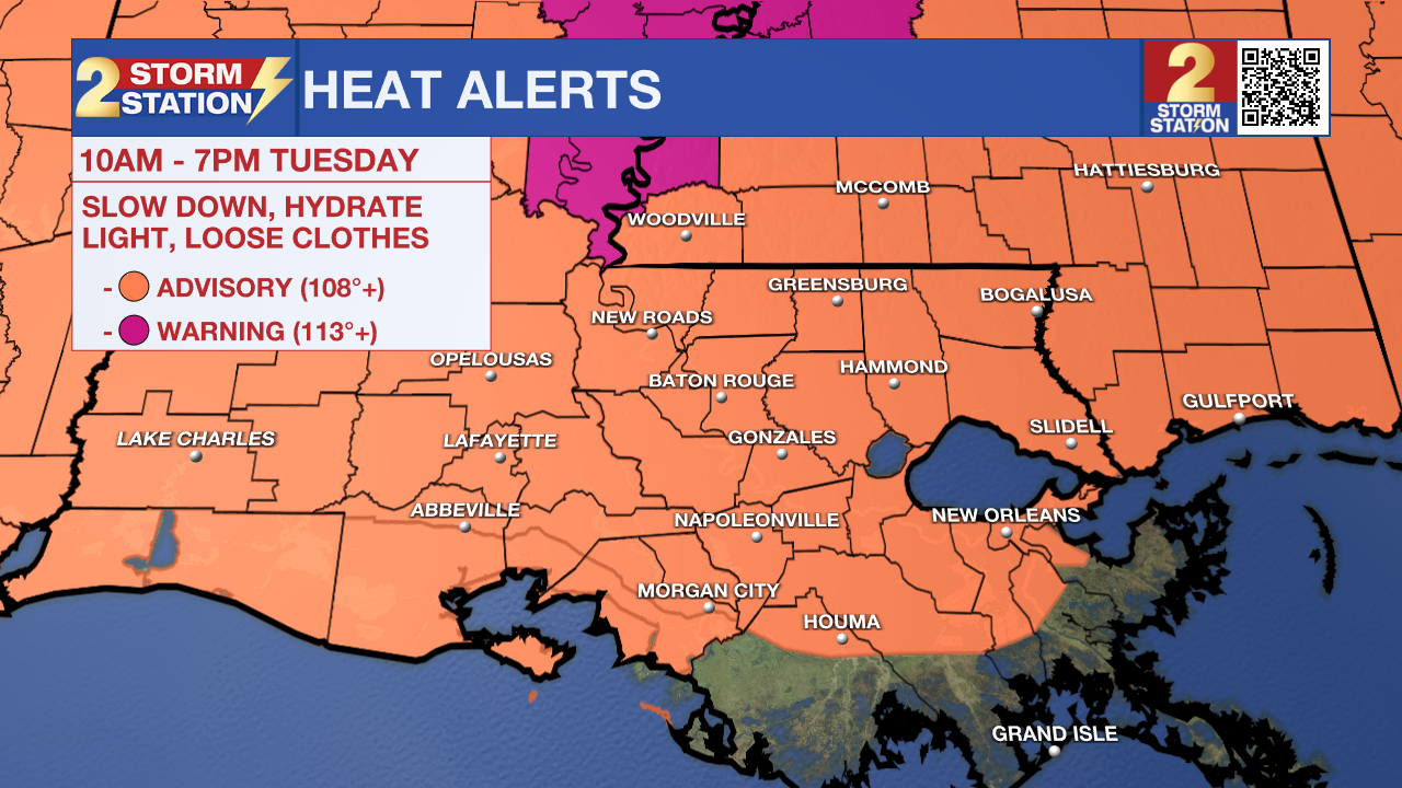
Today & Tonight: Tuesday will bring more heat, humidity, and mostly dry weather. Heat alerts are in place again across the Capital Region, where afternoon highs in the mid-90s will feel more like 105–110° with the humidity. These conditions can become dangerous without proper hydration and/or occasional breaks from the extreme heat. Expect plenty of sunshine with minimal rain chances. Overnight, skies stay mostly clear, and temperatures will only dip into the upper 70s.
Wednesday & Beyond: Another wave of deep Tropical moisture will begin to move into southern Louisiana on Wednesday, The gradual uptick in humidity plus the continuing high heat will only increase the dangerously hot weather through midweek.
An EXTREME HEAT WATCH is in effect for Wednesday, with feels-like temperatures possibly reaching 115° in some areas. The National Weather Service may upgrade this to a Heat Advisory or Extreme Heat Warning later today. No matter the alert, it's important to take breaks, stay hydrated, and listen to your body if you're spending time outdoors.
Alongside the dangerous heat, rain chances will increase late Wednesday as tropical moisture returns. Isolated storms are possible by late afternoon and into the evening, with some lingering overnight. Scattered storms will continue in waves through Thursday and Friday, making for soggier days—but not total washouts. Expect morning spotty showers with more widespread storms each afternoon. Most areas will pick up 1–3 inches of rain, with higher amounts possible, especially closer to the coast.
The Weekend: Over the weekend, expect typical late-July weather conditions; sunny and humid mornings in the 70s, hot afternoons in the low-70s, and occasional pop-up storms during afternoon hours.
Trending News
The Tropics: For the North Atlantic, Caribbean Sea and the Gulf of America, Tropical cyclone formation is not expected during the next 7 days.
Get the latest 7-day forecast and real-time weather updates HERE.
Watch live news HERE.
— Emma Kate C.
The Storm Station is here for you, on every platform. Your weather updates can be found on News 2, wbrz.com, and the WBRZ WX App on your Apple or Android device. Follow WBRZ Weather on Facebook and X for even more weather updates while you are on the go.
More News
