

Latest Weather Blog
Tuesday PM Forecast: multiple alerts in effect for high heat, wetter pattern to bring relief
A HEAT ADVISORY will be in effect Wednesday from 10am to 7pm for the entire forecast area for heat index values over 108 degrees. An EXTREME HEAT WARNING will be in effect for the parishes/triangular area from Baton Rouge to the Northshore to New Orleans for heat index values up to 115 degrees. Heat-related illnesses increase significantly during extreme heat and high humidity events. Hot temperatures and high humidity may cause heat illnesses. Drink plenty of fluids, stay in an air-conditioned room, stay out of the sun, and check up on relatives and neighbors.
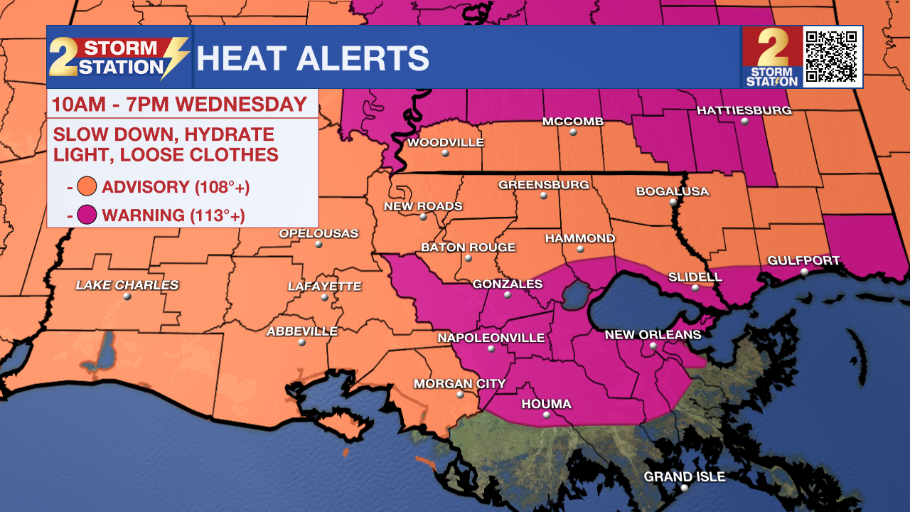
Tonight & Tomorrow: A warm and humid night is ahead. Lows will stop in the mid to upper 70s and the feels-like temperature is likely to remain above 80 through the night. Skies will be mostly clear. Plenty of sunshine is expected early on Wednesday. Highs will climb well into the mid and upper 90s after a fast warming trend to start the day. Heat will feel especially oppressive in the usual spots—those low-lying marshy areas between I-10 and I-12 in southeast Louisiana—where heat index values could soar as high as 115 degrees. Elsewhere, it may not go quite as high, but a heat index over 108 degrees is likely. Later in the day, a pattern change will start to take hold as tropical moisture invades the atmosphere. This will serve as the added boost to start firing showers and thunderstorms to give the heat a break. Isolated activity could develop as early as late Wednesday afternoon, especially closer to I-55.
Up Next: A more substantial and noticeable pattern change will occur on Thursday and Friday. Numerous to widespread showers and thunderstorms are expected each afternoon to end the workweek. There should be a daily rhythm to the showers and thunderstorms where action is near the coast and offshore at night and further inland during the day. Thursday and Friday do not look like full washouts, but most locations should get rain at least once each day. Some thunderstorms could bring downpours and gusty winds. Due to the added precipitation and clouds, most areas should reach the low 90s before getting knocked back by later afternoon.
Though the count in showers and thunderstorms may back off a touch over the weekend, radar should still reveal some activity each afternoon. Plan to have an indoor break option for outdoor activities, but like Thursday and Friday, washouts are not expected. With more dry time, highs will get back near average in the low to mid-90s. Of course, humidity will not break, and nights will stay muggy with lows in the mid-70s.
Trending News
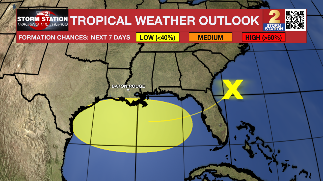
The Tropics: An area of low pressure located on the southern end of a frontal system located off the Southeast Coast will move southwest into the north-central Gulf in the coming days. Conditions may allow for slow development if the system remains far enough offshore. By the weekend, the system will move inland, ending chances for development. Development odds appear low at this time. While this is the same system responsible for boosting storm chances in the Capital Area, tropical development would not change the local forecast.
Get the latest 7-day forecast and real-time weather updates HERE.
Watch live news HERE.
– Josh
The Storm Station is here for you, on every platform. Your weather updates can be found on News 2, wbrz.com, and the WBRZ WX App on your Apple or Android device. Follow WBRZ Weather on Facebook and X for even more weather updates while you are on the go.
More News
