

Latest Weather Blog
Wednesday AM Forecast: Heat peaks today, Rain brings relief tomorrow
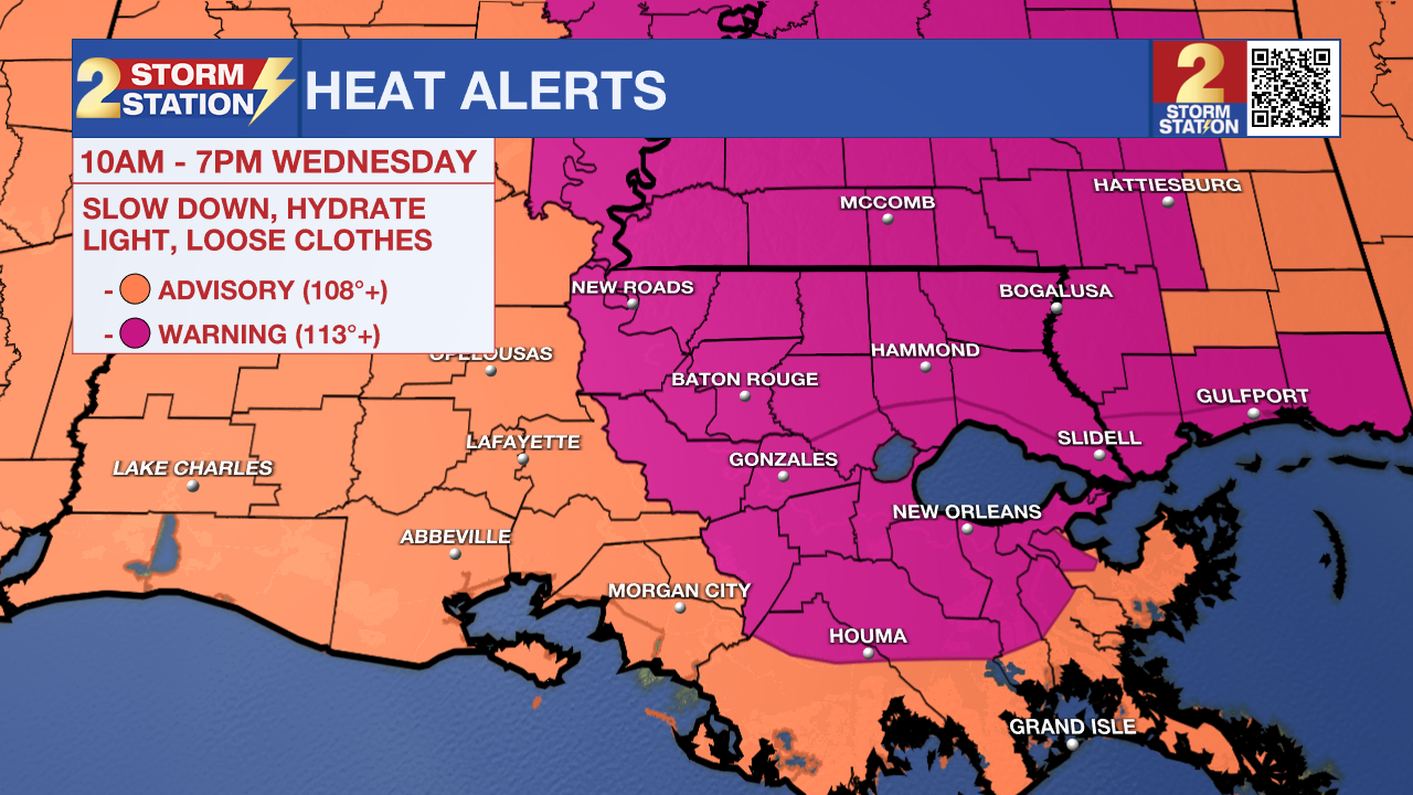
An EXTREME HEAT WARNING will be in effect for the majority of southeast Louisiana and southwest Mississippi for heat index values up to 115 degrees from 10 a.m. to 7 p.m. on Wednesday. Heat-related illnesses increase significantly during extreme heat and high humidity events. Hot temperatures and high humidity may cause heat illnesses. Drink plenty of fluids, stay in an air-conditioned room, stay out of the sun, and check up on relatives and neighbors.
Today & Tonight: Wednesday will start off sunny and heat up quickly, with highs in the mid to upper 90s and heat index values potentially reaching 115°. Later in the day, tropical moisture will move in, helping to spark isolated showers and storms—mainly near I-55—by late afternoon. A few storms could linger into the night. Overnight, temperatures will stay warm in the upper 70s under partly cloudy skies.
Up Next: A noticeable shift in the weather pattern is on the way for Thursday and Friday. Expect scattered showers and thunderstorms each afternoon to close out the workweek. Activity will follow a familiar summertime rhythm—developing offshore and along the coast overnight, then shifting inland during the day. While these days won’t be total washouts, most areas will likely see at least one round of rain daily. Some storms may bring heavy downpours and gusty winds. Thanks to increased cloud cover and rain, highs should top out in the low 90s before rain arrives and helps to cool temperatures a bit in the afternoon.
As we head into the weekend, rain coverage may ease slightly, but isolated afternoon storms will still be in play. If you have outdoor plans, keep an indoor backup in mind. With more breaks in the rain, temperatures will return closer to average, reaching the low to mid-90s. Humidity will remain high, and overnight lows will stay warm and muggy in the mid-70s.
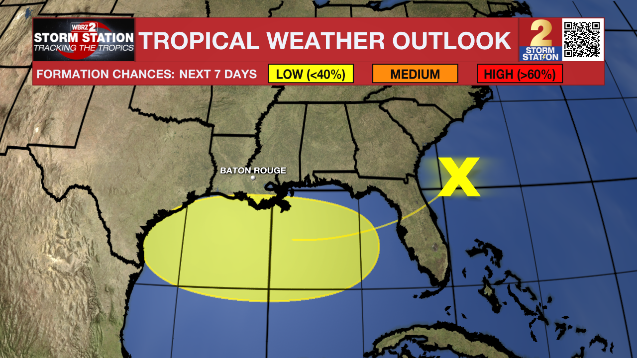
The Tropics: An area of low pressure located on the southern end of a frontal system located off the Southeast Coast will move southwest into the north-central Gulf in the coming days. Conditions may allow for slow development if the system remains far enough offshore. By the weekend, the system will move inland, ending chances for development. Development odds appear low at this time. While this is the same system responsible for boosting storm chances in the Capital Area, tropical development would not change the local forecast.
Trending News
Get the latest 7-day forecast and real-time weather updates HERE.
Watch live news HERE.
– Emma Kate C.
The Storm Station is here for you, on every platform. Your weather updates can be found on News 2, wbrz.com, and the WBRZ WX App on your Apple or Android device. Follow WBRZ Weather on Facebook and X for even more weather updates while you are on the go.
More News
